VIA REGIA

The new lighthouse project "VIA REGIA - Road of Peace" is pioneering in the truest sense of the word. Based on the geographical peculiarity that the Saarpfalz district and its partner districts lie along the "VIA REGIA", the oldest and longest connecting axis between Western and Eastern Europe, a joint model for cooperation in the field of sustainable tourism that promotes education is to be developed.
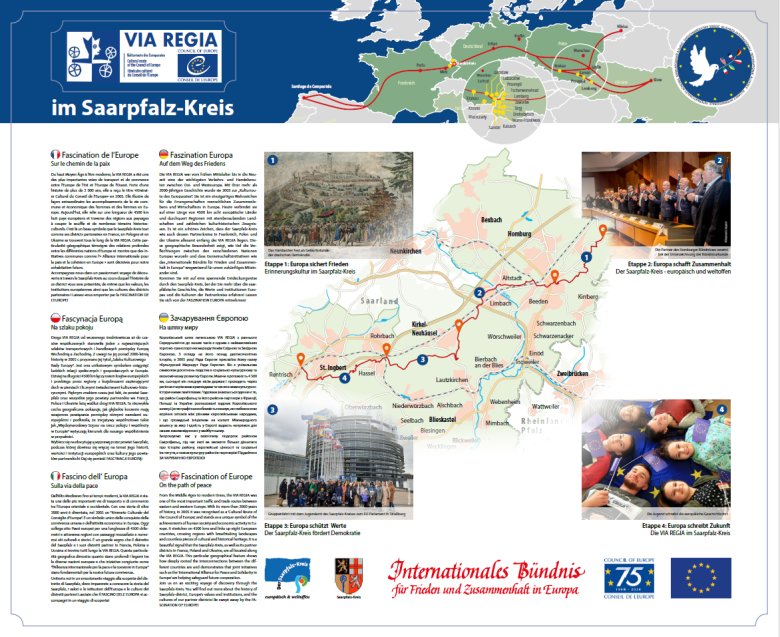
The concrete idea is initially to create a hiking trail with several stations and information boards on the topic of Europe in the Saarpfalz district, which is part of the "VIA REGIA - Cultural Route of the Council of Europe" network that has been in existence since 2009.
will be connected. This will include both general information on the institutions and political facets of the EU as well as local, historical topics. The aim is to create a flexibly expandable information network that can also serve as an ideal learning resource for schools.
On this basis, the alliance partners can design analogue hiking trails in their respective regions, which, with European content, then form part of a cross-border geographical network of trails and in turn make a region-specific contribution to European educational work.
The hiking boards in Homburg will point out all the partner regions along the VIA REGIA. A first prototype was presented in March 2024 as part of the "Homburg Europe Talks" at a joint alliance meeting in the district administration.
In future, an introductory plaque will be placed at all starting points along the European hiking trail. The approximately 40-kilometre route, which leads via Kirkel and Hassel to Rentrisch and is divided into four different stages, was marked with hiking plaques in June 2024 and can now be hiked from five starting points.
You can find more information here: