Allies in Ukraine
Most of the Ukrainian partner districts (rayons) are located in the Lviv oblast. The Lviv Oblast (ukr. Львівська область) with the capital Lviv (Lemberg) is located in the west of Ukraine, on the border with Poland and has an area of 21,831.97 km² and a population of approx. 2.5 million. There has been an official partnership between the Lviv Oblast and Saarland since November 2023.
Lviv Oblast is one of the three regions of the historical and cultural region of Galicia, which is part of the Carpathian Euroregion. It is one of the most economically, touristically, culturally and scientifically developed regions in the country. The oblast was founded on 27 November 1939 following the annexation of what was then the eastern part of Poland by the Soviet Union as part of the Molotov-Ribbentrop Pact.
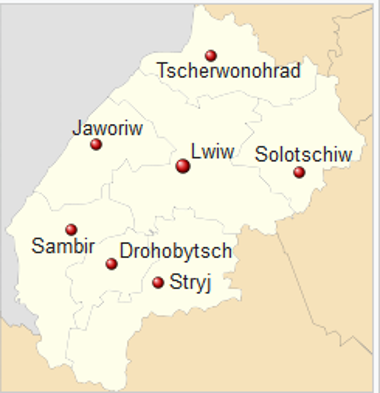
Administratively, it is divided into seven rayons: Lviv, Yavoriv, Zambir, Drohobych, Stryy, Solochiv and Chervonohrad.
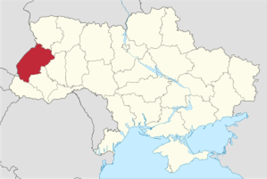
Five of the seven rayons are alliance partners of the Saarpfalz district: the rayon of Lviv, the rayon of Yavoriv, the rayon of Zambir, the rayon of Drohobych and the rayon of Stryj.
Drohobych district (Дрогобицький район)
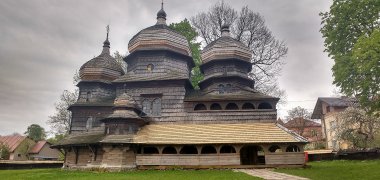 EnnkkoWooden St George's Church from the 16th century, a UNESCO World Heritage Site since 2013
District Council Chairman Andriy Schevkenych
The Drohobych district is located in the Lviv oblast of Ukraine and covers an area of 1,497 km² with a population of around 235,000.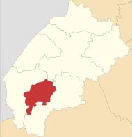 © RosssWThe Drohobych district in the Lviv oblast
The population density is 157 people/km². The administrative centre of the district is the city of Drohobych.The district comprises five municipalities, three of which are urban municipalities and two settlement municipalities.
Yavoriv district (Яворівський район)
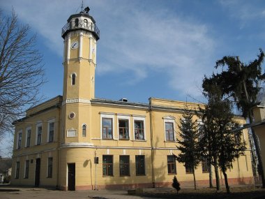 © MShaThe town hall in Jaworiw
District Council Chairman Mykola Romaniuk
The Yavoriv district is located in the Ukrainian Lviv oblast and has an area of 2,101 km² with a population of around 179,000. The population density is 85 people/km². The administrative centre of the district is the city of Yavoriv.
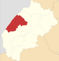 © RosssWThe Yavoriv district in the Lviv oblast
The district comprises six municipalities, four of which are urban municipalities, one settlement municipality and one rural municipality.
Lviv district (Львівський район)
 © Dr Violetta FrysPhilharmonic Hall in Lviv from the inside
District Council Chairman Andriy Sulym
The Lviv district is located in the Ukrainian oblast of Lviv and has an area of 4,976.2 km² with a population of around 1,150,000. The population density is 231 people/km².
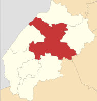 © RosssWThe Lviv district in the Lviv oblast
The administrative centre of the district is the city of Lviv.
The district comprises 23 municipalities, including ten urban municipalities, four settlement municipalities and nine rural municipalities. Since February 2022, the Lviv district has maintained an official district partnership with the Saarpfalz district.
Sambir district (Самбірський район)
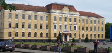 Tomasz LeśniowskiThe university in Sambir
District Council Chairman Vitalij Kimak
The Zambir district is located in the Lviv oblast of Ukraine and has an area of 3,247.1 km² with a population of around 226,000. The population density is 70 people/km².
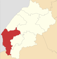 © RosssWThe Yavoriv district in the Lviv oblast
The administrative centre of the district is the town of Sambir.
The district comprises eleven municipalities, seven of which are urban municipalities, one settlement municipality and three rural municipalities.
Stryj district (Стрийський район)
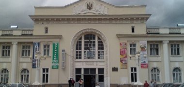 YarikUkraineThe railway station building in Stryj
District Council Chairman Mykhailo Luchechko
The Stryj district is located in the Ukrainian oblast of Lviv and covers an area of 3,854 square kilometres with a population of around 325,500.
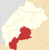 © RosssWThe Stryj district in the Lviv oblast
The population density is 84.46 people/km². The administrative centre of the district is the town of Stryj.
The district comprises 14 municipalities, seven of which are urban municipalities, three settlement municipalities and four rural municipalities.
Other Ukrainian partner districts include the Kalush district, which is located in the Ivano-Frankivsk oblast, the Mariupol district, which is located in the Donetsk oblast, and the Vasylivka district, which belongs to the Zaporizhzhya oblast.
Kalush district (Калуський район)
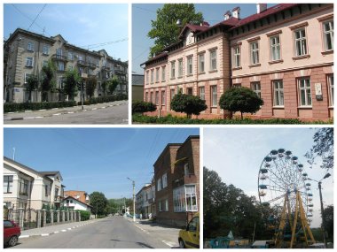 © Kalush14netViews from the town of Kalusch
District Council Chairman Mykhailo Lavriv
The Kalush district is located in the Ukrainian oblast of Ivano-Frankivsk and has an area of 3,550 km² with a population of around 286,500. The population density is 80.7 people/km². The district administration is based in the town of Kalush.
The district comprises 13 municipalities, including three urban municipalities, five settlement municipalities and five rural municipalities.
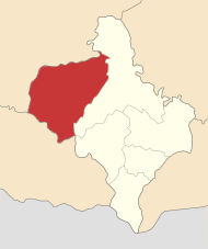 © RosssWThe Kalush district in the Ivano-Frankivsk oblast
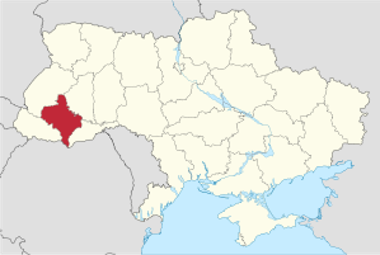 © TUBSThe Ivano-Frankivsk Oblast
Mariupol district (Маріупольський район)
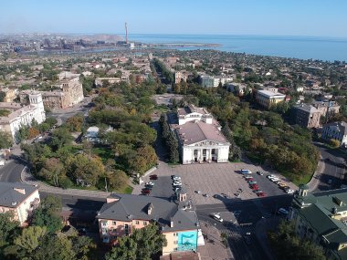 © Лев СандаловThe Donetsk Oblast
District Council Chairman Stepan Makshma
The Mariupol district is located in the Ukrainian oblast of Donetsk and has an area of 2,620 km², on which around 510,500 inhabitants lived before the Russian occupation. The population density was 195 people/km². The administrative centre is the city of Mariupol.
The district comprises 5 municipalities, including one urban municipality, three settlement municipalities and one rural municipality (2022).
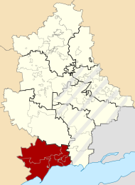 © RosssWThe Mariupol district in the Donetsk oblast
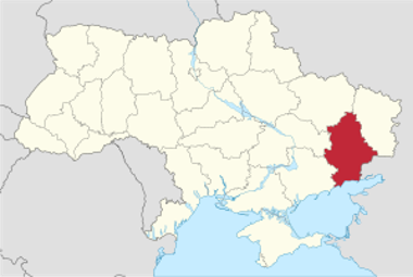 © TUBSThe Donetsk Oblast
Rajon Vasylivka (Василівський район)
District Council Chairwoman Olena Zdor
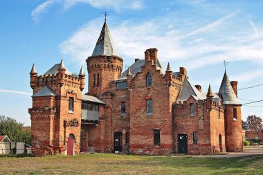 © Oleksandr MalyonThe Oblast of Zaporizhia
The Vasylivka district is located in the Ukrainian Zaporizhzhya oblast and covers an area of 4,287.33 km². The Russian invasion of Ukraine since February 2022 has had a major impact on the population figures and distribution in Ukraine.
Prior to this, the Vasylivka district had a population of around 188,500 and a population density of 44 people/km².
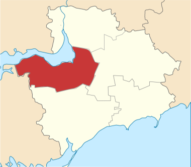 © RosssWThe Vasylivka district in the Zaporizhzhya oblast
The administrative centre is the town of Vasylivka. The district is divided into two towns, one settlement municipality and eleven administrative municipalities.
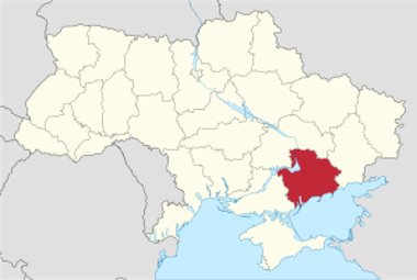 © TUBSThe Oblast of Zaporizhia